
Conquering the Finger Lakes Trail
A 14-day hike through the Finger Lakes trails with our pets: Good weather, great views … and an injured knee
By Eva Briggs, MD
I’ve been working on completing the Appalachian Trail. Trail and hostel closures due to COVID-19 meant no AT hiking this year.
Instead, my friend and I decided to spend June on a less strenuous backpacking trip along the Finger Lakes Trail. Before I departed, I decided to write about that adventure upon my return.
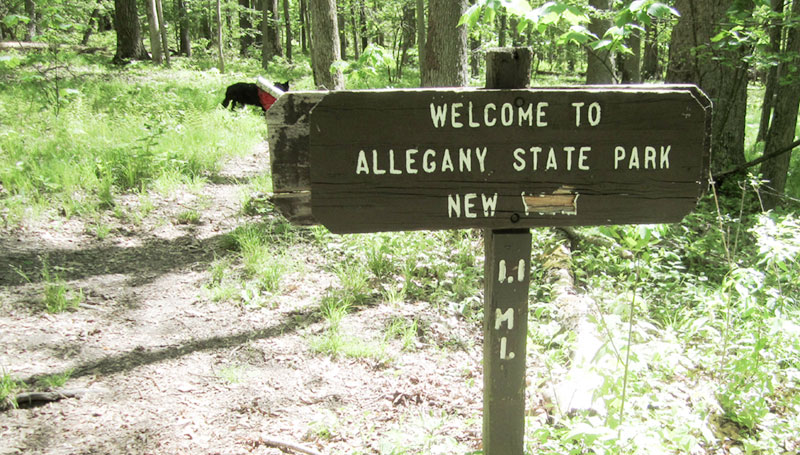
The Finger Lakes main trail starts just over the state line in Pennsylvania in Allegany State Park. It runs east for 575 miles to the Catskill Forest Preserve. An additional six side trails, plus 29 spur and loop trails, bring the total distance to about 1,000 miles.
The trail crosses a mixture of state and private lands with landowner permission. It’s maintained entirely by volunteers.
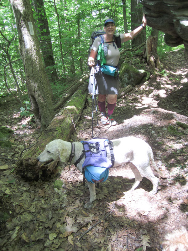
My friend Nadine and I, her golden doodle Yankee, and my dogs Boomer and Reilly met the morning of June 1 to start our trek in Allegany State Park. Our cars were stuffed full with a month supply of backpacking food, our hiking gear, plus luxury items (folding chairs, large portable battery recharger, etc.) for use when camping near our cars. We planned to leap frog our cars every one to three days in order to minimize our pack weights.
The weather was perfect: sunny, cool and breezy. Our first stretch was three days covering 21 miles, or map M01.
The Finger Lakes Trail Conference sells maps, and we purchased the set of main trail maps, numbered M01-M34. Day 1 we saw exactly four people on the trail, the most we saw hiking on any one day. We spent the night in our tents at Willis Creek lean-to, mile 7.2. Right on schedule, we completed M01 in three days. The only rain was two brief thunderstorms during the second night and third morning. Despite a lot of lightning and thunder, there was not much rain or wind.
The trail through M01 was well-marked. During the remainder of our trip, many of the trails were overgrown (trail maintenance was on hold due to COVID-19) or poorly marked. Luckily, I had purchased both the paper and digital trail maps. An app called Gaia GPS, plus my compass, let me use my phone’s GPS to figure out the tricky spots.
Hiking strategy
We also learned to check the Finger Lakes Trail Council website for the most up-to-date information about trail closures and detours due to logging, landowner request, or other issues. We once were delayed 45 minutes when a logging truck was being loaded. We made the executive decision to skip over long or busy road walks. Our dogs didn’t care for them, and neither did we. After all, there was no way we’d finish the entire main trail in 30 days, so we stuck to the places we would enjoy.
Alas, our hike lasted only 14 days because I injured my knee. I have arthritis of my knees, and dislocated my kneecap in such a way that it totally locked my knee. Ouch! Even after I got my kneecap into place, the pain and swelling, despite a day of total rest followed by low mileage days carrying just a daypack, were too much.
The knee was going to be replaced July 20.
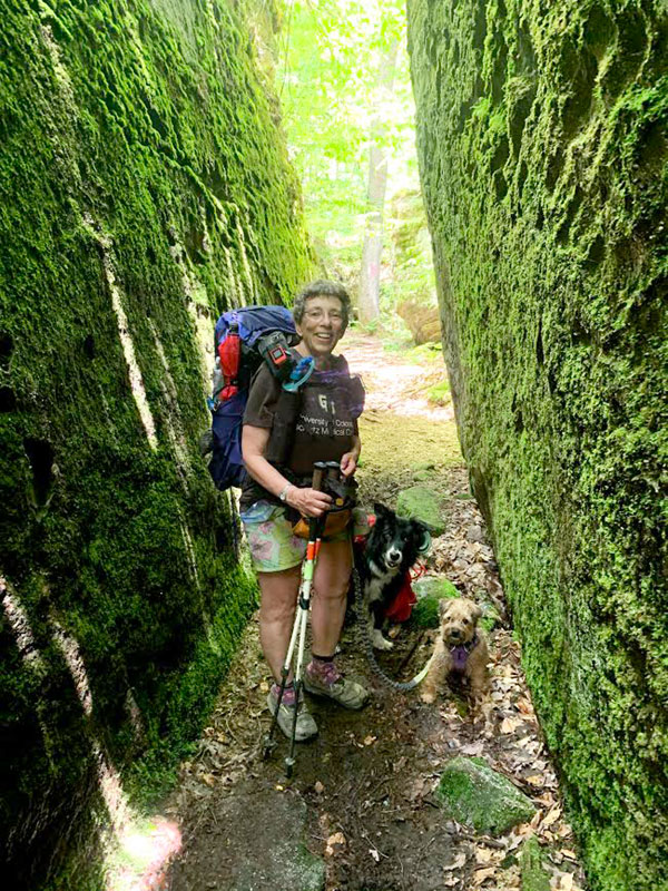
The visual highlight of the trip was Little Rock City in Rock City State Forest in Salamanca. Giant chunks of conglomerate rock form the “buildings” and “roads.” These boulders are pieces of conglomerate rock that have broken off over thousands of years and been carried by slow soil creep. Here we saw many people bouldering, a form of rock climbing performed on small rock formations without ropes or harnesses. Most used big mats to prevent injuries from falls.
Shortly after Rock City is Camp Seneca, site of a former Civilian Conservation Corps camp. There is a large picnic pavilion and surrounding grassy area. We spent the night there. Alas, there was a major party going on at the pavilion, with about 50 people without masks or social distancing.
We kept our distance after returning some unsupervised barefoot, lost children we found on the trail about a mile before we reached the party. Their families had not even noticed them missing.
We constantly had to shoo away additional unsupervised children. I told them that our dogs were tired and needed to take naps, and that worked.
We ultimately traversed 94 miles, finishing in Portageville Map M06, just south of Letchworth State Park.
Hopefully next year my knee will be better, we’ll have a COVID-19 vaccine, and Nadine and I can complete the Appalachian Trail.
Photo: The Finger Lakes main trail starts just over the state line in Pennsylvania in Allegany State Park. It runs east for 575 miles to the Catskill Forest Preserve.